Florida is famous for beaches, wetlands, and long stretches of flat ground. Mountains rarely come to mind when people picture the state. Yet names such as Sugarloaf Mountain and Hobe Mountain can make visitors wonder whether there is a different landscape waiting beyond the coast.
So, does Florida have mountains? Florida has hills, ridges, and steep river bluffs, but it does not have high mountain ranges. Some places carry mountain names even though their height and appearance are closer to what most visitors would call hills.
The two places that cause the most confusion are Britton Hill and Sugarloaf Mountain. Britton Hill is the highest natural point in the entire state, while Sugarloaf is the highest point on the Florida peninsula. Understanding that difference helps you choose where to visit and know what to expect when you arrive.
Quick Answer
No, Florida has no mountain ranges. Its highest natural point is Britton Hill at 345 feet, while Sugarloaf Mountain, the highest point on the peninsula, reaches 312 feet. Florida’s high ground is hills, ridges, dunes, and river bluffs.
Quick-Guide Table
Helpful List: Visit Florida’s High Points in 5 Steps
- Decide which high point you want: Britton Hill for the statewide record, Sugarloaf Mountain for the peninsula’s highest point.
- Check access before stopping — a map label does not mean a public park or parking area, and homes and private land surround Sugarloaf.
- Check the weather before leaving and watch for thunderstorms; seek proper shelter rather than continuing toward an exposed viewpoint.
- Carry drinking water, wear suitable footwear, and use sun protection — short, steep climbs and loose sand can be tiring.
- Respect posted boundaries, keep driveways clear, and watch carefully for cyclists on the hills and bends around Sugarloaf.
Does Florida Have Mountains? The Clear Answer
Florida does not have mountains in the everyday sense of tall peaks and mountain ranges. Its natural high ground consists of relatively low hills, sandy ridges, and uplands. You will not find an alpine landscape or a chain of towering summits.
However, saying that Florida has no “true mountains” needs a little explanation. The U.S. Geological Survey notes that there are no official definitions separating mountains, hills, and peaks in American geographic naming. There is no single height rule that settles every case.
A place can therefore have “Mountain” in its official or familiar name without resembling the mountains of Colorado or North Carolina. The name is real, but it does not promise a particular landscape.
For travelers, the practical answer is straightforward: Florida offers interesting changes in elevation, but anyone expecting a traditional mountain holiday should adjust those expectations.
Why Some Florida Hills Are Called Mountains
Place names often reflect how a feature looks within its surroundings. In a low landscape, a hill can stand out strongly enough to earn a mountain name. That name may remain even when visitors from hillier regions find the feature surprisingly small.
Two measurements help explain the confusion. Elevation is the height of a place above sea level. Local relief describes the difference in height between higher and lower ground nearby.
A hill reaching 300 feet above sea level does not necessarily involve a 300-foot climb. If your starting point is already elevated, the climb may be much shorter. Likewise, a lower hill rising sharply from flat surroundings can feel more noticeable than a higher point on a broad ridge.
This is why Florida’s highest natural point and its most noticeable roadside climb do not have to be the same place. The shape of the surrounding land matters as much as the summit number.
How Florida’s Hills And Ridges Formed
Florida’s higher ground developed through several processes over a long period. Changing sea levels, ancient shorelines, windblown sand, and erosion all helped shape the landscape visitors see today.
Lake Wales Ridge provides a clear example. Parts of this Central Florida ridge preserve ancient beach and dune systems. During periods when higher seas covered much of the surrounding land, elevated areas remained above the water as islands.
Those sandy uplands now support distinctive habitats. Their importance extends beyond their height because they provide homes for plants and animals adapted to these conditions.
However, it would be inaccurate to describe every Florida hill as an ancient sand dune. In other areas, rivers have cut into layers of rock and sediment, leaving bluffs and ravines. The slow dissolving of limestone has also shaped uneven ground.
Florida’s hills share a generally low elevation, but they do not all share one simple origin.
Britton Hill: The Highest Point In Florida
Britton Hill is the highest natural point in Florida at 345 feet, or approximately 105 meters, above sea level. It lies in northern Walton County in the Panhandle, close to the Alabama border.
Its location explains why some visitors overlook it. People planning trips around Orlando, Miami, or the Florida Keys may be nowhere near this northern corner of the state.
Britton Hill also holds an unusual national distinction: it is the lowest of the 50 U.S. state high points. Every other state has a highest natural point above Florida’s.
The setting is modest. You will not see a sharp summit rising dramatically above the landscape. The attraction is reaching a geographic landmark and experiencing a quieter part of Florida.
When someone asks about the highest point in FL, Britton Hill is the correct statewide answer. Sugarloaf Mountain’s name does not change that ranking.
Visiting Britton Hill And Lakewood Park
Lakewood Park provides the familiar visitor setting for Britton Hill. The high-point monument gives travelers a clear place to recognize the location and take a photograph.
The surrounding wooded ground offers short walking opportunities. Rather than planning for a strenuous summit hike, think of the visit as a gentle stop with a geographic point of interest.
This makes Britton Hill appealing to people who enjoy collecting state high points, taking quieter road trips, or discovering places beyond Florida’s major attractions. Its appeal comes from its significance rather than dramatic scenery.
Allow time to enjoy the setting instead of arriving with expectations of an expansive mountain panorama. Trees and the gentle shape of the land influence the experience.
Check current local information before making a special journey, particularly if you need specific facilities or accessible routes. A high-point marker alone does not tell you what amenities will suit your visit.
Sugarloaf Mountain, Fl: The Peninsula’s Highest Point
Sugarloaf Mountain reaches 312 feet, or about 95 meters, above sea level in Lake County. It is recognized as the highest natural point in peninsular Florida.
The word “peninsular” is important. It refers to the part of Florida extending south between the Gulf and the Atlantic, rather than the Panhandle. Britton Hill stands in the Panhandle and remains higher overall.
The difference between their commonly reported elevations is 33 feet. Although that is a small gap, the two places offer different experiences because of their surroundings.
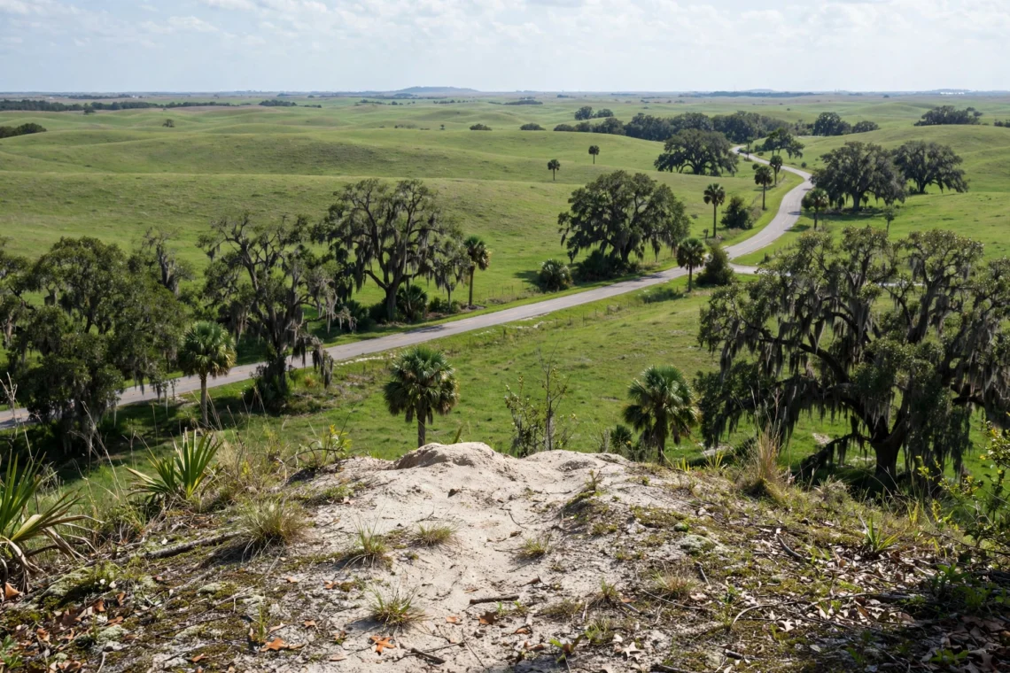
Sugarloaf attracts attention for its rolling landscape and challenging road climbs. In a region many travelers expect to be flat, the slopes can feel surprisingly substantial.
A visit to Sugarloaf Mountain, FL, is therefore about discovering Central Florida’s hills. It is not a trip to the state’s highest summit, and it does not involve a conventional mountain resort.
Finding Sugarloaf Mountain Near Clermont And Minneola
Florida’s Sugarloaf Mountain lies in Lake County, north of Clermont and near Minneola. Those nearby communities explain why online searches use several versions of its location.
“Sugarloaf Mountain Clermont” and “Sugarloaf Mountain Minneola FL” generally refer to the same hill and surrounding area. They should not be treated as separate mountain destinations.
The Orlando connection is broader. Sugarloaf is west of Orlando, making it relevant to travelers exploring beyond the city. However, describing it as a mountain inside Orlando would be misleading.
When checking a map, look for Sugarloaf Mountain in Lake County and confirm the surrounding roads. Searching only the name can bring up similarly named places in other states.
Choose your route from your actual starting point rather than relying on a general driving-time estimate. Travel conditions around Orlando vary, and the journey depends on which part of the area you are leaving.
What To Expect Around Sugarloaf Mountain
The landscape around Sugarloaf is known for rolling roads, slopes, and stretches of higher ground. The wider Green Mountain Scenic Byway area attracts visitors who enjoy scenic driving and road cycling.
Cyclists are especially interested in Sugarloaf because its climbs offer a change from flatter Florida routes. A hill does not need a high summit elevation to demand effort when the road rises steeply.
For other visitors, the main attraction is seeing a less familiar side of Central Florida. The experience is more about the changing countryside than reaching a developed summit attraction.
Do not assume that every viewpoint, driveway, or patch of open ground is publicly accessible. Homes and private land form part of the surrounding landscape. A map label does not automatically identify a public park or parking area.
Check access before stopping, keep driveways clear, and respect posted boundaries. Drivers should also watch carefully for cyclists on the hills and bends.
Britton Hill And Sugarloaf Mountain Compared
Britton Hill and Sugarloaf Mountain answer different versions of the same question. One is Florida’s statewide high point; the other is the peninsula’s highest point.
| Feature | Britton Hill | Sugarloaf Mountain |
| Elevation above sea level | 345 feet | 312 feet |
| Location | Northern Walton County, Panhandle | Lake County, near Clermont and Minneola |
| Main distinction | Highest natural point in Florida | Highest natural point in peninsular Florida |
| Setting | Gentle wooded high ground | Rolling Central Florida hills |
| Main visitor interest | High-point monument and short walks | Scenic surroundings and road cycling |
Choose Britton Hill if reaching Florida’s highest natural point is your main goal. It makes particular sense when your journey already takes you through the Panhandle.
Sugarloaf is more relevant to a Central Florida itinerary. It suits visitors interested in hilly scenery or cycling, provided they understand the access arrangements.
Neither should be chosen on the assumption that the word “highest” guarantees the widest view or hardest climb.
Other Florida Landscapes With Hills And High Views
Florida’s varied high ground extends beyond its two best-known high points. Lake Wales Ridge shows how ancient sandy uplands can create a landscape quite different from the state’s beaches and wetlands.
Its interest lies partly in its natural history. These old dune and shoreline systems support unusual habitats, giving visitors a reason to explore beyond simply measuring elevation.
Hobe Mountain, in Jonathan Dickinson State Park, is another example of a mountain name attached to a dune landscape. The natural dune rises 86 feet above sea level and forms part of the Atlantic Coastal Ridge. Its height is modest, but its setting helps explain why it stands out locally.
Torreya State Park offers a different kind of terrain. High bluffs overlook the Apalachicola River, while wooded slopes and deep ravines create a more rugged impression.
Those features result partly from the river cutting into the landscape. They should not be described as another ancient dune system or a separate mountain range.
Together, these places show why “Florida is flat” is useful shorthand but an incomplete description.
Sugarloaf Ski Resort And Property Searches Explained
Sugarloaf Mountain in Florida is separate from Sugarloaf ski resort in Carrabassett Valley, Maine. The shared name can cause confusion when search results mix travel destinations.
The Maine resort is a mountain destination associated with skiing. Florida’s Sugarloaf is a low hill in Lake County and does not offer that alpine resort experience. Check the state before using directions, booking accommodation, or reading activity information.
Property searches create another overlap. Results for “Sugarloaf Mountain FL homes for sale” concern housing in the surrounding area, rather than visitor access to the hill.
A property listing may describe a neighborhood, address, or view, but it should not be used as a guide to public recreation. For a sightseeing visit, focus on confirmed public routes and access information.
These distinctions help readers find the right place without turning a simple Florida geography question into an unrelated ski or property search.
Planning A Visit To Florida’s Hilly Areas
Low elevation does not automatically mean an effortless outing. Short, steep climbs can be tiring, especially when repeated. Loose sand can make walking harder, while roots and uneven ground can slow progress on wooded trails.
Choose a route based on its surface, length, and climbing rather than its highest elevation alone. A short walk at Britton Hill and a demanding road ride around Sugarloaf require very different preparation.
Heat and humidity also affect comfort. Carry drinking water, wear suitable footwear, and use sun protection where routes are exposed. Avoid treating a low hill as a reason to overlook ordinary outdoor preparation.
Check the weather before leaving and watch for thunderstorms. If thunder develops, seek proper shelter rather than continuing toward an exposed viewpoint.
Current access information matters just as much as the forecast. Review official park notices, trail conditions, and local road information before traveling. Storm damage, maintenance, or construction can affect a route even when older travel articles describe it as available.
Finally, plan around the experience you actually want. Choose a designated walking area for a relaxed hike, a suitable cycling route for hill training, or Britton Hill for the satisfaction of visiting Florida’s high point.
Conclusion
Does Florida have mountains? It has places called mountains, but its natural landscape consists of low hills, ridges, dunes, and bluffs rather than high mountain ranges. The names are part of Florida’s geography, even when they suggest something taller than visitors will find.
Britton Hill is the highest natural point statewide at 345 feet. Sugarloaf Mountain reaches 312 feet and holds the distinction for peninsular Florida. Knowing which is which prevents a common travel mix-up.
These places are worth understanding on their own terms. Visit for the geographic landmark, rolling countryside, or unusual Florida terrain, with realistic expectations and a clear plan for public access.
FAQ’s:
Does Florida Have Any Mountain Ranges?
Florida has no high mountain ranges. Its elevated landscapes include hills, sandy ridges, and river bluffs. Places named “mountain” exist, but those names do not indicate tall peaks or alpine scenery.
What Is The Highest Natural Point In Florida?
Britton Hill is Florida’s highest natural point at 345 feet above sea level. It lies in northern Walton County near Alabama and is the lowest state high point in the United States.
Is Sugarloaf Mountain Higher Than Britton Hill?
No. Sugarloaf Mountain reaches 312 feet above sea level, making it 33 feet lower than Britton Hill. Sugarloaf is the highest natural point in peninsular Florida, while Britton Hill holds the statewide distinction.
Is Sugarloaf Mountain In Orlando?
Sugarloaf Mountain is in Lake County, near Clermont and Minneola, west of Orlando. Searches sometimes associate it with Orlando because of the wider travel area, but it is not inside the city.
Can You Ski At Sugarloaf Mountain In Florida?
Florida’s Sugarloaf Mountain is not a ski resort and has no alpine skiing facilities. The well-known Sugarloaf ski resort is in Carrabassett Valley, Maine, so check the state when researching your trip.
Disclaimer
This article is provided by travel3ways.com for general informational and travel-planning purposes. It does not guarantee public access, suitable conditions, or the availability of facilities at any location. Weather, opening hours, road access, and park rules may change. Check current information with the relevant park or local authority before traveling, follow posted guidance, and respect private property.